Bilder Quantitative Biogeographie

FireMIP

Selected scientific project outcomes

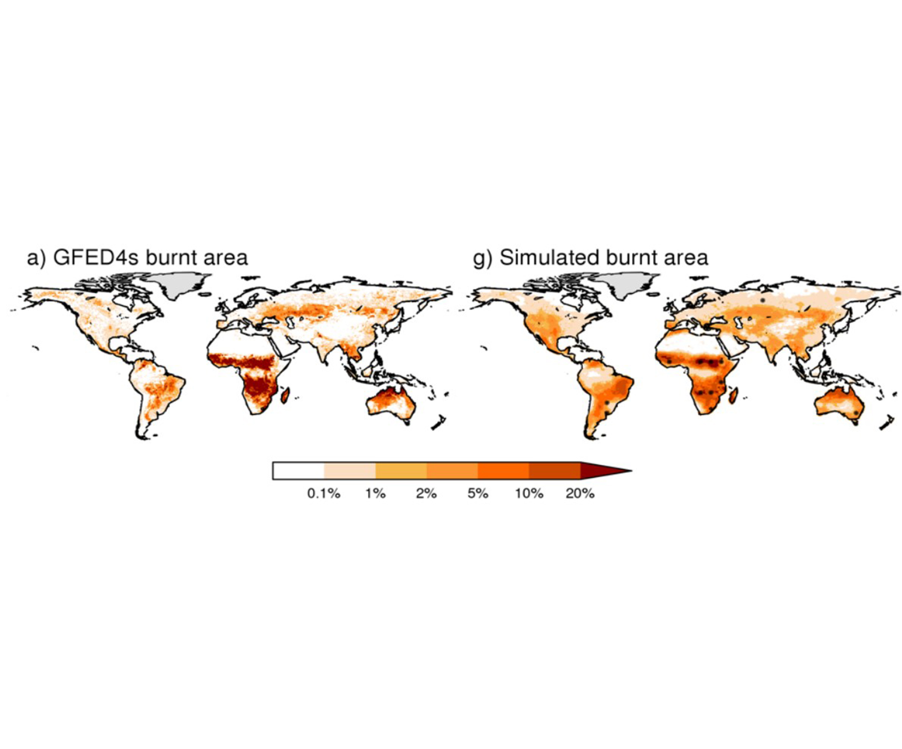
The comparisons within the Fire Model Intercomparison Project (FireMIP) showed that the models reproduce the spatial patterns and global totals of burned area (Figure 1) and emissions (Forkel et al., 2019; Li et al., 2019; Teckentrup et al., 2019; Hantson et al., 2020).

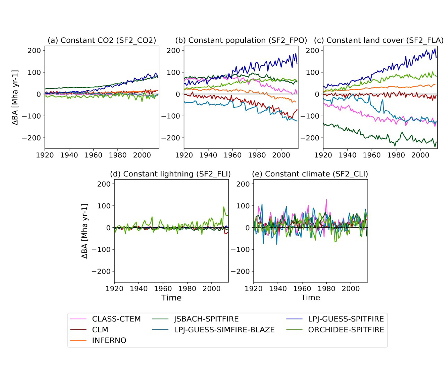
The simulations over the historical period show a strong divergence in simulated burned area trends for the recent two decades (Andela et al., 2017) and the last century (Teckentrup et al., 2019). This divergence in trends between models was attributed to anthropogenic factors based on the sensitivity simulations (Teckentrup et al., 2019; Li et al., 2019, Figure 2).

Models did not show a strong trend due to changes in climate over the 20th century; however, a strong influence of climate on the interannual variability was identified (Teckentrup et al., 2019). Anthropogenic fires influence seasonality, and explicitly including cropland fires improves the seasonality of fire in the Northern Hemisphere (Hantson et al., 2020).

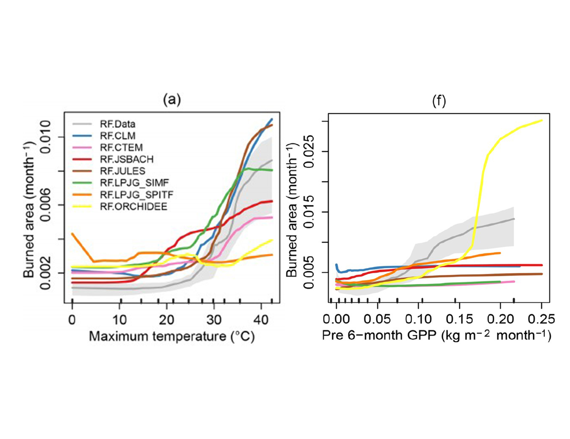
A multivariate analysis using random forest showed that the response of mean burned area to climatic variables was reasonable; however, models did not reproduce the relationship between vegetation productivity and burned area well (Forkel et al., 2019, Figure 3).

Bilder Quantitative Biogeographie
Figure 1: Annual burned area fraction observed by satellite (a) and simulated by FireMIP models (b). Hantson et al. (2020).
Bilder Quantitative Biogeographie
Figure 2: Changes in burned area due to the forcing factors (CO2, population density, Land cover, Lightning, Climate) for the participating models. (Teckentrup et al., 2020)
Bilder Quantitative Biogeographie
Figure 3: Response of burned area to maximum temperature and vegetation productivity of the preceding six months, derived using random forest and observations (grey) and models (coloured) (Forkel et al., 2019).
Figure 4: Spatial distribution and latitudinal gradients of GPP (a), vegetation carbon (b), total terrestrial carbon (c), and turnover times (d), from observation driven estimates (first column), reference simulation including fire (second column) and the impact of fire, estimated as the difference between reference simulation and simulations without fire (third column). (Lasslop et al., 2020)

Overall, the outcomes of FireMIP so far have shown that the models are able to reproduce present-day burned area and emission patterns and have revealed the human impacts and sensitivity to vegetation as major fields for model development.

As the models capture the spatial patterns well for the present day, we applied them to provide the first multi-model estimate of fire impacts on global tree cover and the carbon cycle under current climate and anthropogenic land use conditions. Fire reduces the tree covered area and vegetation carbon storage by 10%. Regionally the effects are much stronger, up to 20% for certain latitudinal bands, and 17% in savanna regions. The influence on vegetation productivity or total carbon storage is much lower (Lasslop et al., 2020, Figure 4).